
My Top Five Go To Photography Spots in Marlborough NZ
Back in May of 2007 I moved to Marlborough from Northland; prior to relocating I had only visited the region once. In 2007 I was based in Marlborough and spent the first two years travelling the wine regions across the South Island selling vineyard machinery, and after that period my focus narrowed to the Marlborough area alone. Since Marlborough is New Zealand’s largest wine region, with over 30,000 hectares of vines planted, I was able to explore and become familiar with a substantial portion of the district.
After purchasing my first interchangeable lens camera in late 2019, I began travelling much more throughout Marlborough, this time exploring the district with a camera to photograph its landscapes, seascapes, and hidden details. With several years of experience journeying across the region, I’d like to share my top five photography spots within Marlborough.
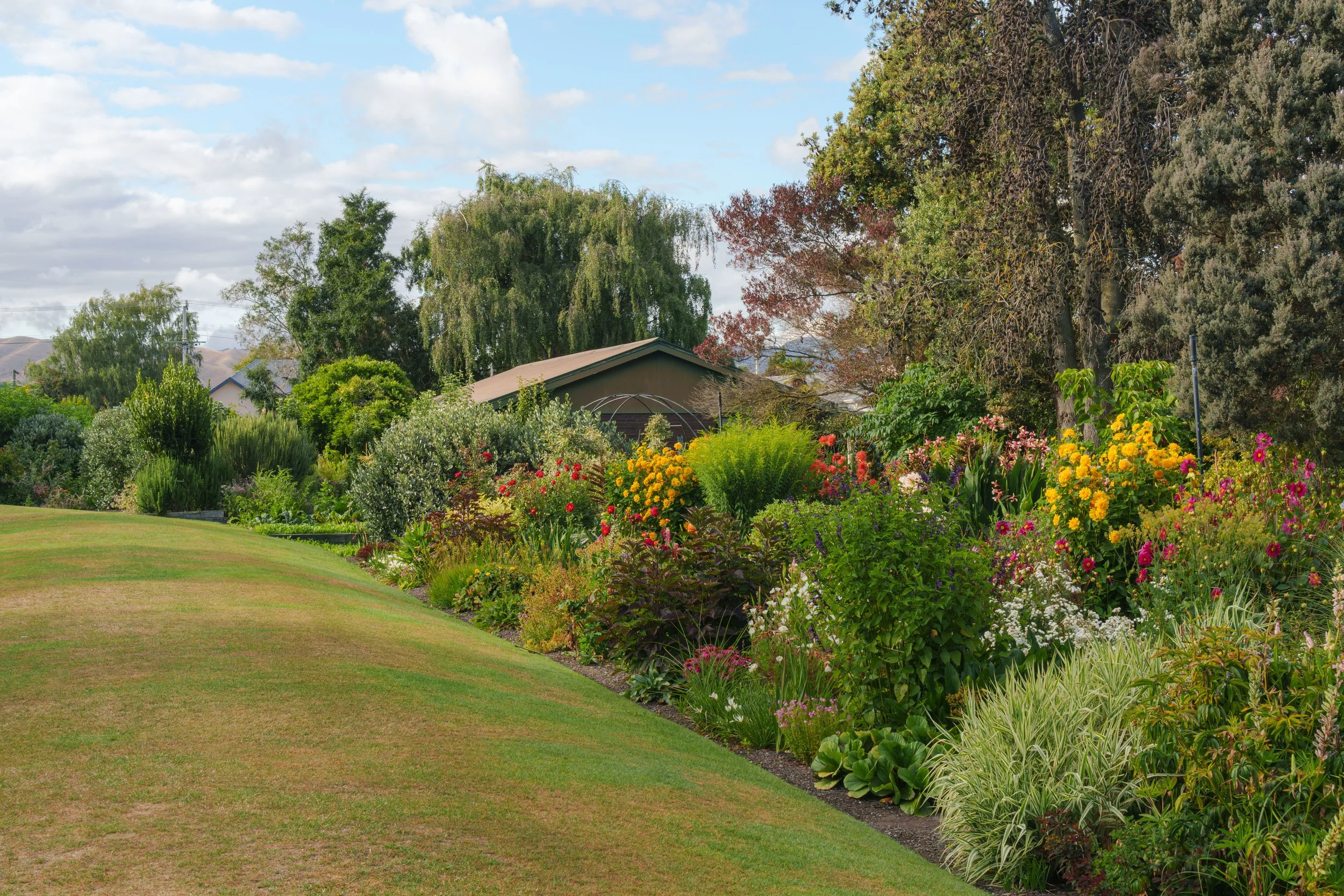
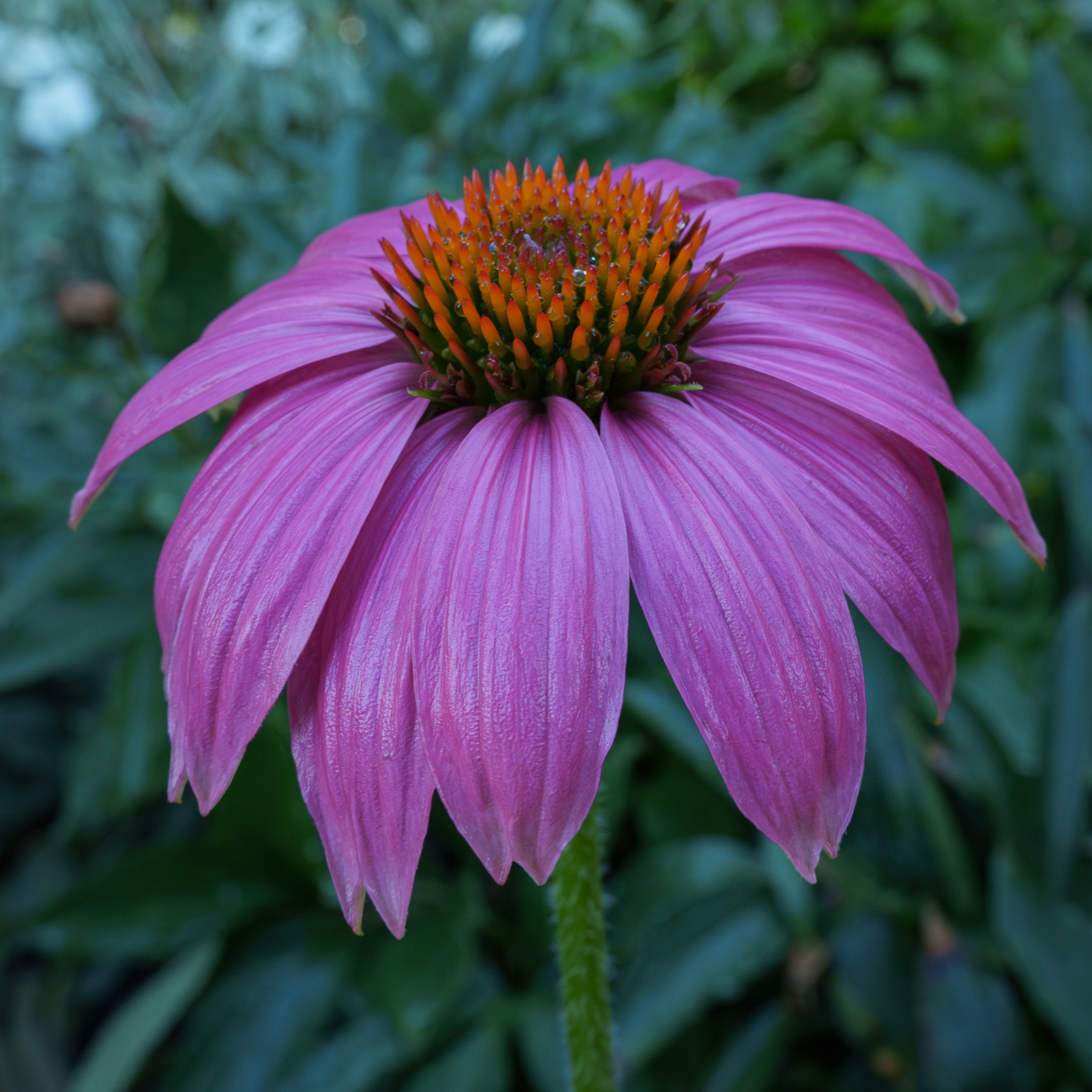
Pollard Park and Seymour Square: - These gardens are a wonderful asset to Marlborough. The Marlborough District Council gardeners do an excellent job keeping the two gardens in immaculate condition. During the winter I visit the gardens when the weather allows, but from spring onwards I visit weekly to try to capture macro and close-up photos of flowers and insects. Over the years I’ve learned to look for blooms in good condition and avoid those in direct sunlight, as strong sun tends to wash out the colours; overcast days are perfect for rich, even tones. By early November and throughout the summer I step up my visits to two or three times a week to take advantage of peak flowering and insect activity.


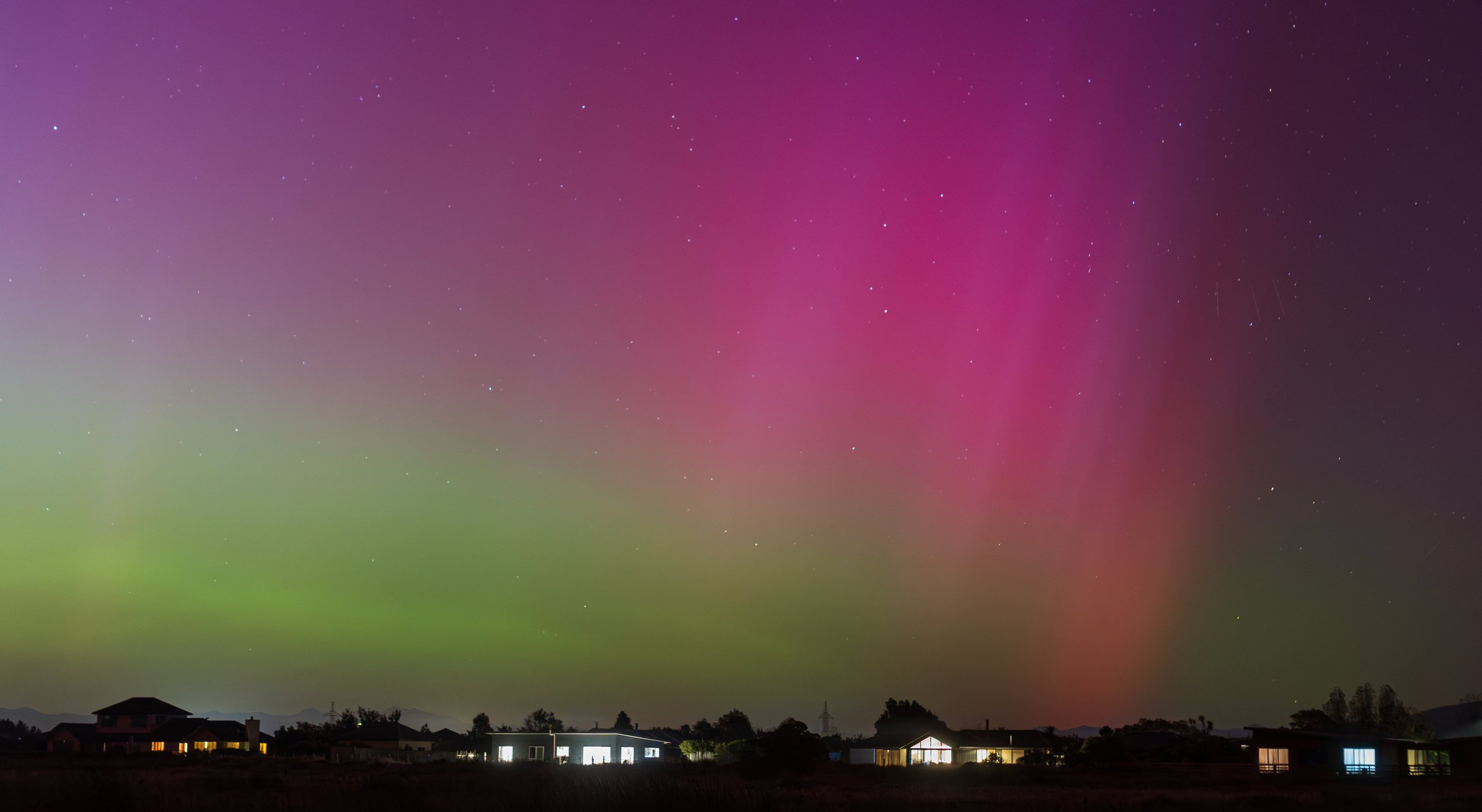
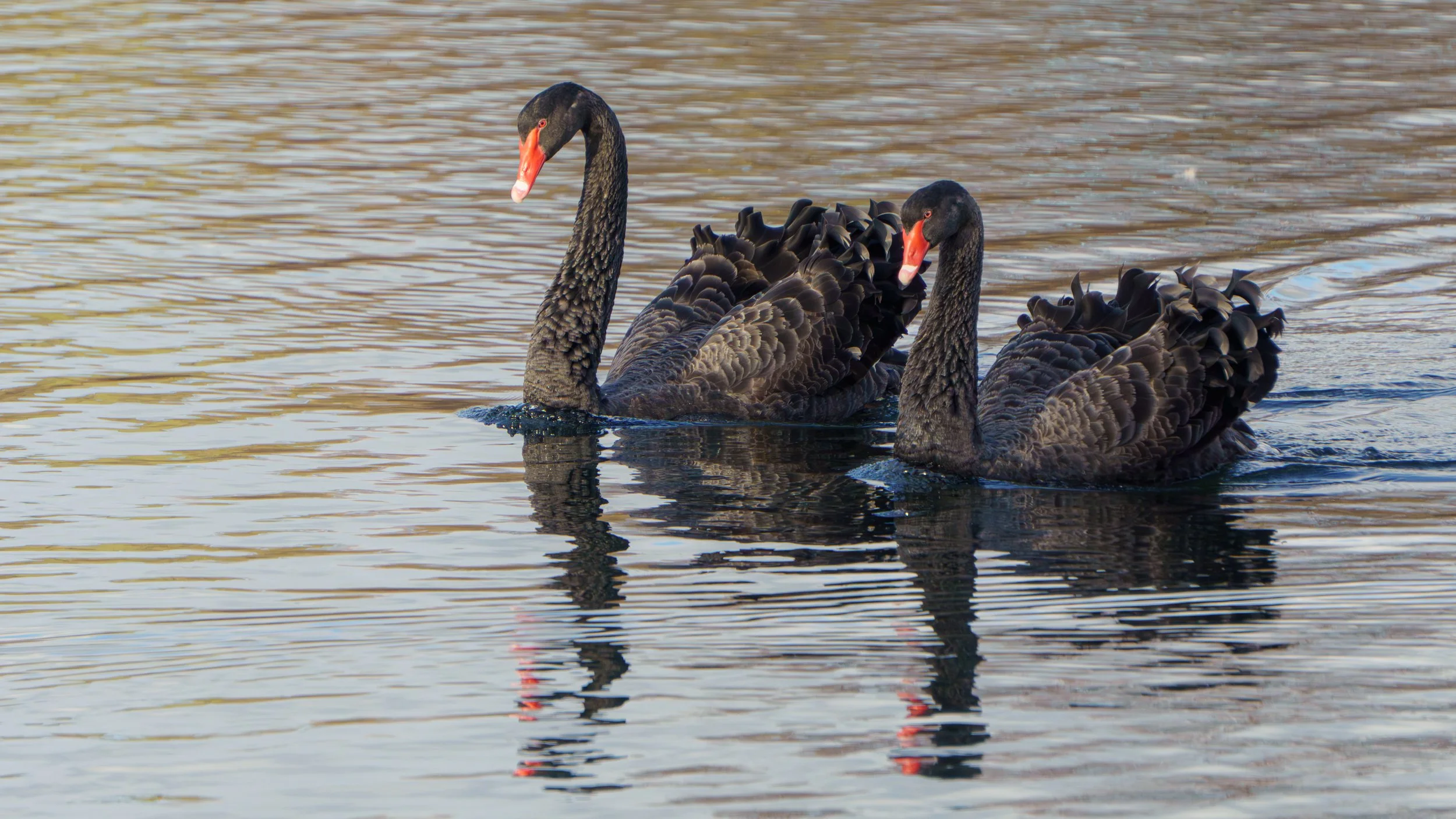
Marlborough Sounds: - The Marlborough Sounds consist of three main, interconnected bodies of water: Queen Charlotte, Pelorus, and Kenepuru Sounds. At the head of Queen Charlotte Sound is Picton, a large port town where the inter-island ferries connect the North and South Islands of New Zealand, and which also serves as a regular destination for large cruise ships. Havelock is a smaller port town at the head of Pelorus Sound and provides access to Kenepuru Sound. Connecting Picton and Havelock is the Queen Charlotte Drive, which also gives road access toward the Kenepuru Sound. In July 2021 a severe weather event in Marlborough caused extensive damage to roads through the Sounds from numerous landslides; the road to the Kenepuru Sounds did not reopen to public access until 2025. When travelling the Queen Charlotte Drive it is generally best to start from Havelock, as the scenic lookouts are on the left-hand side of the road and therefore easier and safer to access than when travelling from Picton. Along the drive there are many bays with striking coastal views and a variety of walking tracks. There are also numerous options for boat cruises throughout the Marlborough Sounds, and the area is home to native birds (weka, king shag) and diverse marine life (dolphins, seals).


Awatere Valley: - Driving through the golden hills and vineyards of the Awatere Valley, you'll find snow-capped mountains to one side and the blue Pacific Ocean on the other, a striking contrast that changes with the seasons and light. The valley rises to the region's highest peak, Mount Tapuae-o-uenuku, central to Māori legend and standing as the tip of the Southern Alps. The Awatere is the entrance to the vast Molesworth Station, New Zealand's largest high country farm. Acheron Road is open from October to April and you can drive through to Hanmer Springs, or you can turn right at the Jacks Pass/Rainbow junction and take the St Arnaud Road through Rainbow Station to St Arnaud. In the time I have lived in Marlborough I have never driven through to Hanmer Springs via Molesworth Station, mainly because a four wheel drive is recommended and it would be too hard on my small car. I do travel up the Awatere Valley Road regularly as far as crossing the Awatere River at the Medway Bridge, approximately a 30 km drive from State Highway One, and then continue driving up Welds Hill. Part way up there is a layby that gives a lovely scenic view across the valley, a peaceful spot to stop, breathe, and take in the sweeping landscape.


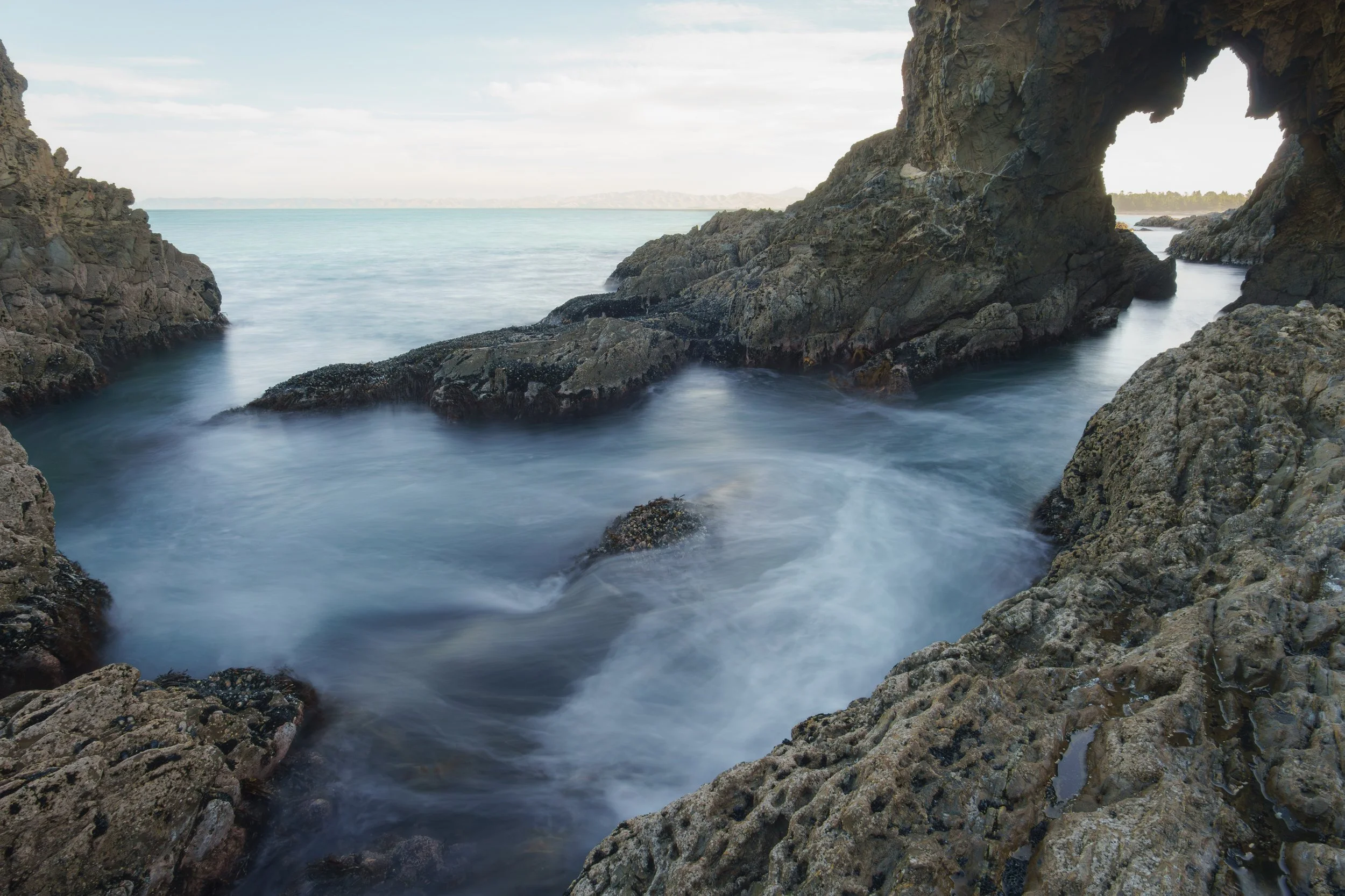
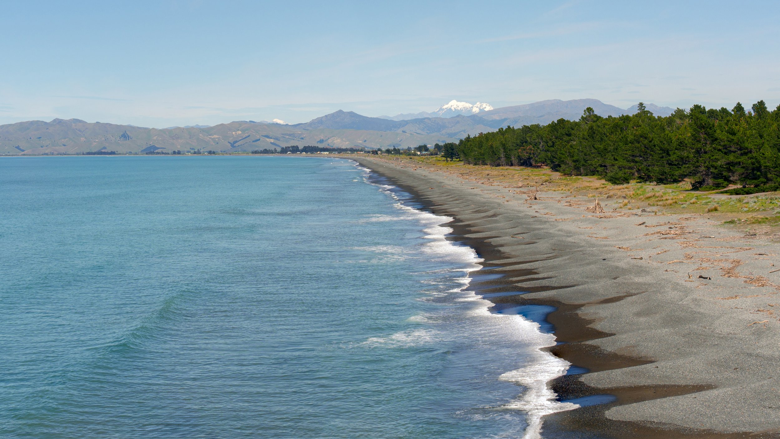
Rarangi Beach and Whites Bay: - Rarangi Beach is a very small, beach settlement situated about a 15-minute drive to the northeast of Blenheim, on the scenic coast of Cloudy Bay. Rarangi is a rugged, picturesque shoreline, characterised by coarse sand, abundant driftwood, strong surf, and shifting dunes, and it offers a range of outdoor activities such as camping, surf casting for fish, walking the shore, and exploring its distinctive coastal flora and fauna. A short walk up some steps at the northern end of Rarangi Beach leads around a rocky point into the sheltered cove of Monkey Bay, which has its own small, peaceful beach. A lookout near the start of the track provides excellent panoramic views over Rarangi Beach and the surrounding seascape. Whites Bay, just over the hill from Rarangi, is a bright, safe bay ideal for swimming, with a clean white sandy beach and a naturally sheltered inlet. Beyond swimming, visitors to Whites Bay can climb to the lookout for expansive views, explore the interesting rock pools, enjoy fishing, or relax overnight at the nearby camp ground.

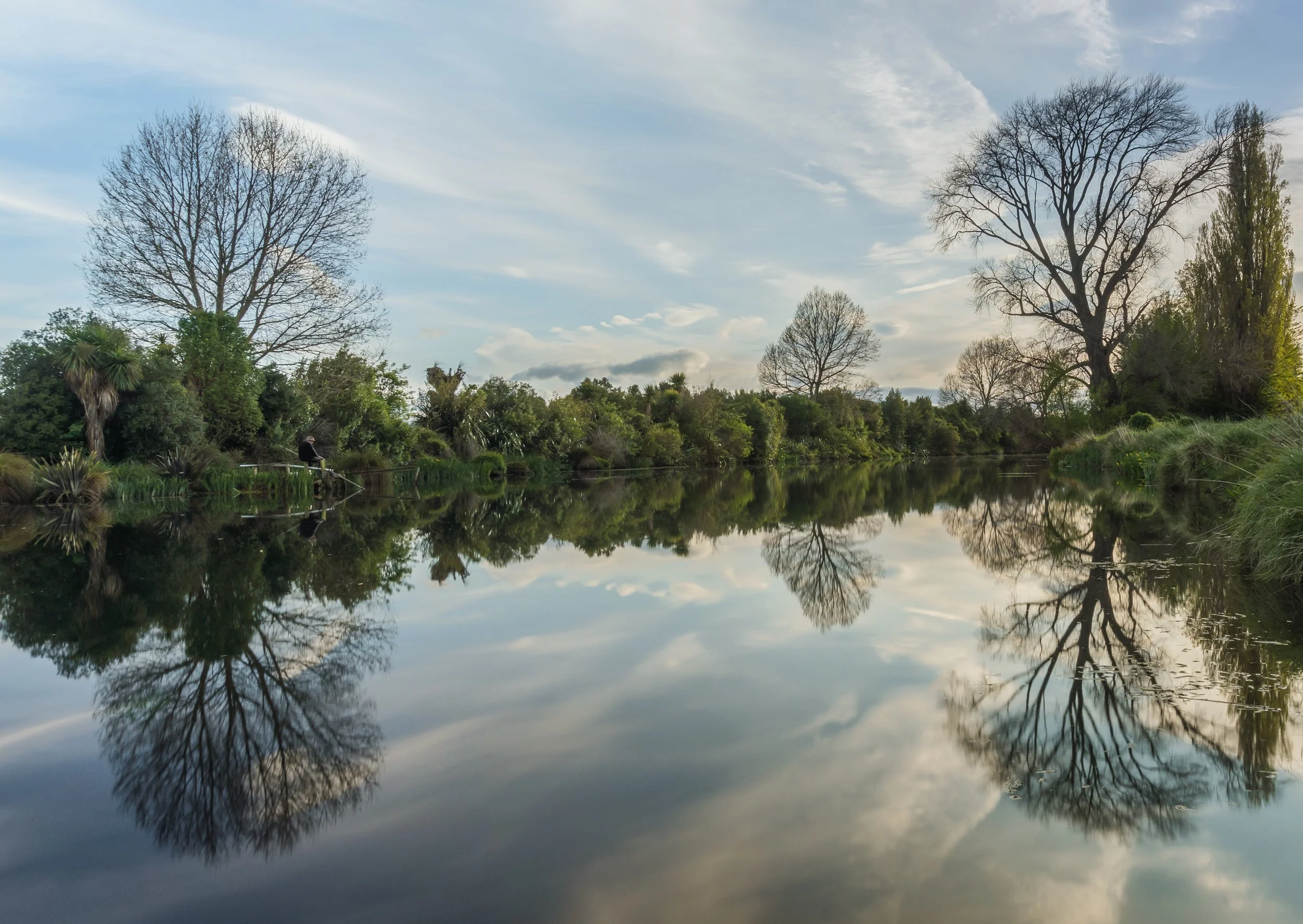
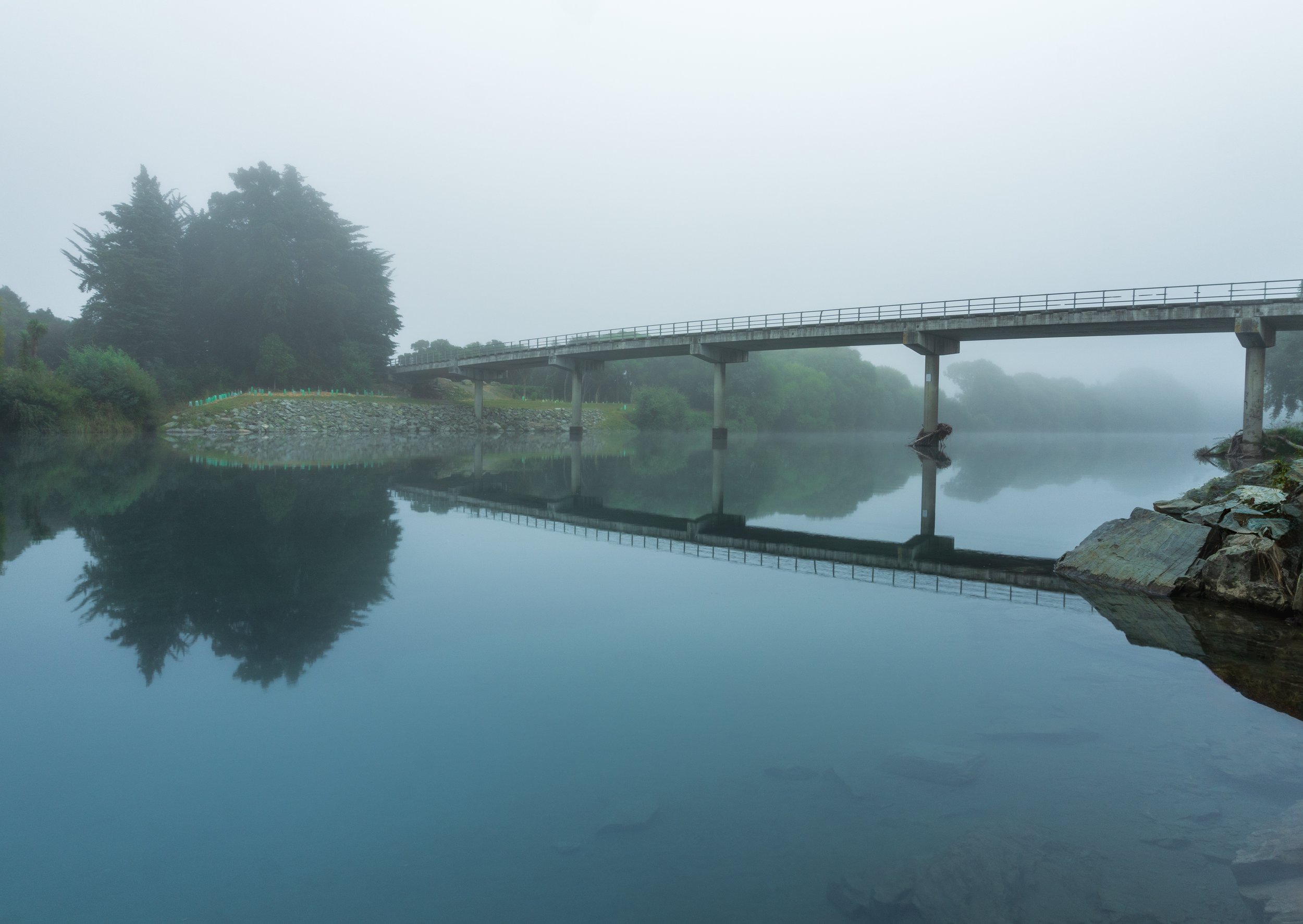
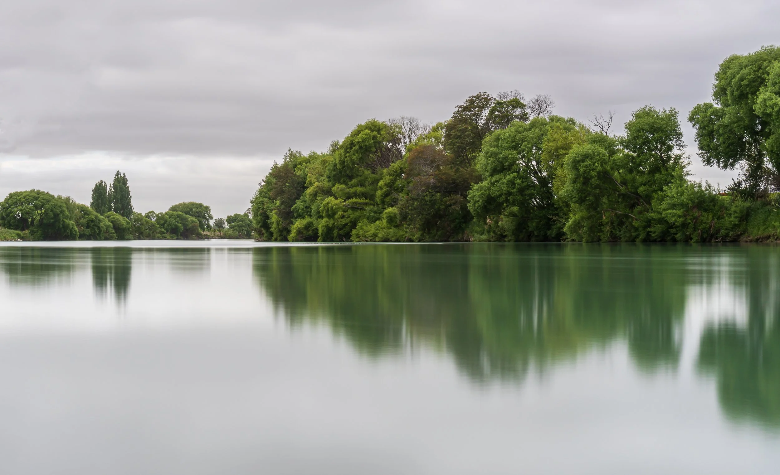
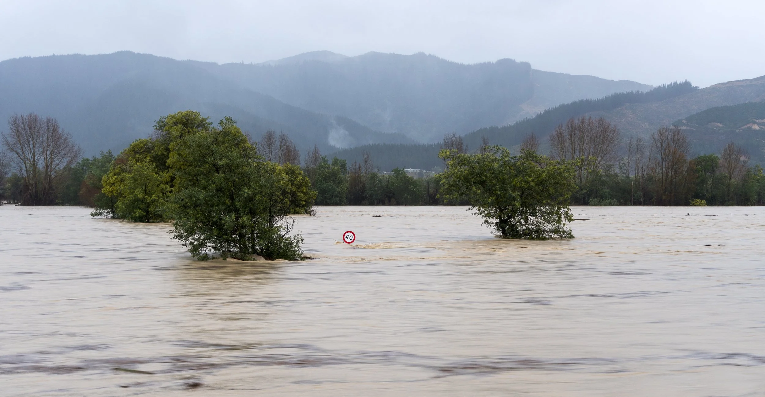
The Rivers: - Marlborough has a multitude of rivers throughout the region, with the Wairau River being the longest and most significant. It flows for 170 kilometres from the Spenser Mountains, a northern range of the Southern Alps. The river’s lower reaches and the surrounding fertile plain provide the foundation for the Marlborough wine region, supporting extensive vineyards and agriculture. Ultimately the Wairau makes its way to the coast, with its outflow into Cook Strait at Cloudy Bay. The Wairau River Diversion, is an artificial channel running from State Highway 1 at Tuamarina out to Cloudy Bay. It’s designed to reduce flood risks to communities such as Spring Creek, and is a more reliable path for floodwaters to reach the sea. The river is well known for fly fishing for Trout and Salmon and whitebait.
The Ōpaoa River, formerly called the Opawa River, begins in the Wairau Valley where several floodways come together. It winds its way down the valley and flows through, looping around the eastern suburbs of Blenheim. Within Blenheim it joins the Taylor River and then continues on to flow into Big Lagoon, the estuary it shares with the southern mouth of the Wairau River at Cloudy Bay. The Taylor River, which originates in Taylor Pass and flows through Blenheim before joining the Ōpaoa River, winds through a mix of rural and urban landscapes. Along its course the river also passes through the Taylor Dam, an area that supports a wide variety of wildlife and offers a peaceful habitat for birds, fish, and other native species.
With such an extensive river system throughout Marlborough, flooding can be an issue; with any significant rainfall the rivers can quite quickly become raging torrents. The river shingle is constantly shifting and reshaping the course of the water, so what was a reliable photo location one season may be quite different six months later.
Well, those are my top five go to photography spots in Marlborough. There are many other places I photograph, but too many to list in a single blog post. One notable change I’ve been seeing across the region is the impact of pine forestry on the backgrounds of many scenes. As the pine trees mature they are being harvested, leaving visible scars on the landscape until the new forest regrows. What were once iconic clean backdrops for landscape photography, they have now become more cluttered or disrupted, so I’m continually scouting and experimenting to find fresh compositions and viewpoints within Marlborough.